France Avenue Modification Near Jefferson High School
Project Overview
This summer, changes are coming to France Avenue (CSAH County Road 17) to improve safety for people driving, walking, and biking—especially near the school.
This project is already funded and scheduled by Hennepin County through a pavement maintenance project and County signal maintenance staff. The feedback we are collecting now will not change the 2026 improvements but will help prioritize future projects in this area and gather input for a potential school zone speed limit.
What We’re Aiming to Do
- Slow traffic to safer speeds
- Make it easier and safer to cross the street to access the schools and trail
- Improve safety at key intersections and school areas
- Improve the longevity of the pavement with routine pavement management treatments
Timeline
- Summer 2026: Pavement preservation (chip seal), new striping, and signal updates
- 2026–2027: Potential school zone speed limit installation
Project Limits
- North Limit: Between W 98th Street and Pebblebrook Drive
- South Limit: Old Shakopee Road (CSAH 1)
What’s Changing
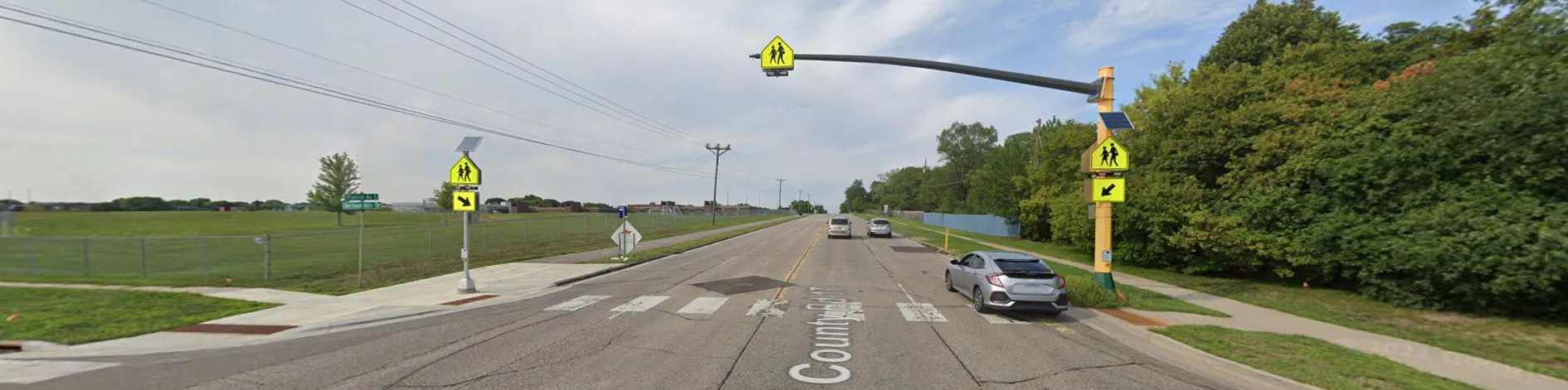
France Avenue will be restriped from a four-lane road to a three-lane road (one lane in each direction with a center turn lane). Instead of two lanes in each direction, France Avenue will have one lane in each direction, and one center lane for turning. This will calm traffic and discourage speeding.
This design is widely used to reduce speeding and improve safety.
Additional improvements include:
- Safer intersection design at 102nd Street, including dedicated left turn lanes
- Traffic signal updates to provide flashing yellow signals,
- Safer school crossing at the school crossing at Heritage Hills/Canterbury with fewer lanes to cross

Why This Matters
This corridor serves a school and has frequent pedestrian activity. These changes are designed to reduce crashes, improve visibility, and create a safer environment for everyone using the road.
Hennepin County Project Information
More information about the Hennepin County road maintenance project can is available on the project website, https://www.hennepincounty.gov/services/roads-bridges/road-maintenance-projects
Have Other Safety Concerns?
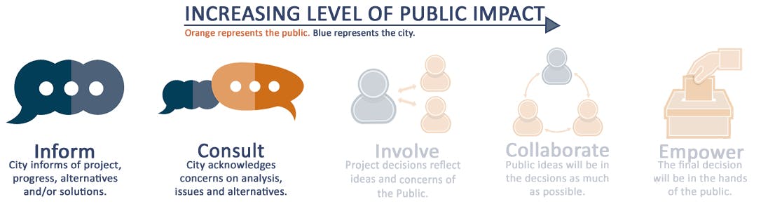
The changes being made with this project advance the goals of the Active Transportation Action Plan and will improve safety in response to resident concerns that we have heard in the past.
We are collecting additional input for future improvements in this area.
Use the map below to tell us:
- Where do you feel unsafe walking, biking, or driving?
- Are there crossings, intersections, or areas that need attention?
- What specific issues have you experienced (speeding, visibility, congestion, etc.)?
Your input will help shape a future corridor study for W 102nd Street, be included in an upcoming Safe Routes to School Plan Update, and guide future safety improvements.
Who's Listening
-

-

-

Phone 952-563-4532 Email amarohn@bloomingtonmn.gov