
Bloomington Ferry Road Corridor Visioning Study
Share Bloomington Ferry Road Corridor Visioning Study on Facebook
Share Bloomington Ferry Road Corridor Visioning Study on X (formerly Twitter)
Share Bloomington Ferry Road Corridor Visioning Study on Linkedin
Email Bloomington Ferry Road Corridor Visioning Study link
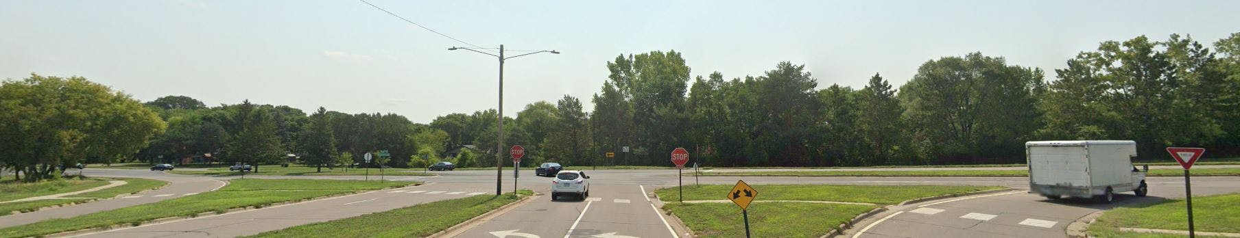
 The City of Bloomington is undertaking a corridor visioning study for Bloomington Ferry Road from Ensign/Veness Road to Dred Scott Park/110th Street. This is an opportunity for the City to revisit the needs of all users along Bloomington Ferry Road and create a roadway that better serves the current and future users of the corridor. Once a preferred vision is identified, future pavement, safety and other projects on this corridor will work towards implementing this adopted vision.
Study goals:
- better utilize the existing right-of-way to serve all users (motorists, bicyclists and pedestrians);
- improve management of traffic at intersections;
- enhance pedestrianContinue reading

Page last updated: 14 Apr 2026, 10:47 AM
Who's Listening
-

Phone 952-563-4532 Email amarohn@bloomingtonmn.gov -

Phone 952-563-4540 Email drezac@bloomingtonmn.gov
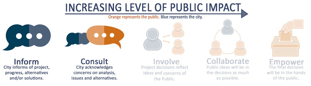
Level of Engagement
Important Documents
-
 BFR Open House 1 Boards.pdf (4.57 MB) (pdf)
-
Open House 2 Informational Boards (4.24 MB) (pdf)
-
Corridor Layout Concept A - One way Bikeways and Sidewalks (24.8 MB) (pdf)
-
Corridor Layout Concept B - Shared Use Paths (23.4 MB) (pdf)
-
Corridor Layout Concept C - Two way Bikeway and Sidewalks (24.5 MB) (pdf)
-
Open House 2 Comment Card (171 KB) (pdf)
-
Bloomington Ferry Road_City Council 12222025.pdf (1.87 MB) (pdf)
-
Bloomington Ferry Road Corridor Visioning Study Report_without Appendices.pdf (2.26 MB) (pdf)
