
Bloomington Ferry Road Corridor Visioning Study
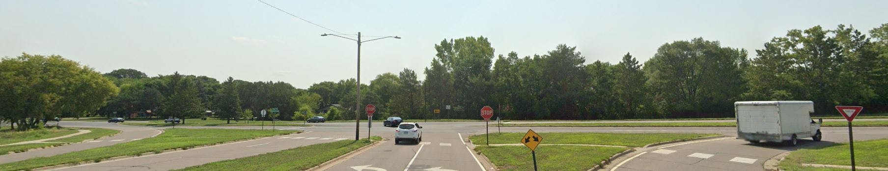
 The City of Bloomington is undertaking a corridor visioning study for Bloomington Ferry Road from Ensign/Veness Road to Dred Scott Park/110th Street. This is an opportunity for the City to revisit the needs of all users along Bloomington Ferry Road and create a roadway that better serves the current and future users of the corridor. Once a preferred vision is identified, future pavement, safety and other projects on this corridor will work towards implementing this adopted vision.
Study goals:
- better utilize the existing right-of-way to serve all users (motorists, bicyclists and pedestrians);
- improve management of traffic at intersections;
- enhance pedestrianContinue reading
-
Final Report
Share Final Report on Facebook Share Final Report on X (formerly Twitter) Share Final Report on Linkedin Email Final Report link
The final report for the Bloomington Ferry Road Corridor Study is now available in the "Important Documents" on this page. The full report with appendix is a large file and available upon request.
-
Recommended Concept
Share Recommended Concept on Facebook Share Recommended Concept on X (formerly Twitter) Share Recommended Concept on Linkedin Email Recommended Concept linkBased on the results of the study, including the engineering analysis outcomes, the evaluation measurables for the project goals in the areas of water resources, sustainability, mobility and cost, and the public engagement feedback, the Technical Advisory Committee (TAC) recommendation for the Bloomington Ferry Road Corridor Vision is Concept C:
 Concept C: Roadway with one-lane in each direction and turn lanes at intersections and two-way off-road bike path parallel to one side of the road and sidewalk parallel to both sides of the road
The TAC recommendation also includes a recommendation that when the final design is created for each segment construction that the design works to maintain as much infrastructure as possible, such as maintaining one curb line and storm sewer.
The TAC also provided recommendations for interim improvements (to advance prior to future re-construction projects on the corridor) that include:
- Corridor: Lane reduction with striping changes
 Example of Existing Corridor with Striping Changes
 - Veness Road: Signal removal (all-way stop) with bump-outs and approach lane reduction
- Lindstrom Drive: Curb bump-outs with lane reduction and crosswalk
- Yukon Avenue: Curb bump-outs with lane reduction
- 102nd Street: Signal removal (side street stop), lane reduction, and Rectangular Rapid Flashing Beacon (RRFB) enhanced crosswalk
 Veness Road
 Lindstrom Drive
 Yukon Avenue
 102nd Street
This is the recommendation being brought to City Council that is recommended for adoption.
- Corridor: Lane reduction with striping changes
-
Open House #2 Materials
Share Open House #2 Materials on Facebook Share Open House #2 Materials on X (formerly Twitter) Share Open House #2 Materials on Linkedin Email Open House #2 Materials link
Thank you to all of those that were able to attend the open house on Tuesday, September 23 at Sunrise Park. We had some good conversations and received a lot of feedback on the layouts and through the comment cards.
If you were not able to attend, the open house boards and corridor concepts are now available to view from this page. To access look for "Important Documents" in the right hand column. The informational boards are named Open House #2 Boards. The corridor layouts are available separately and are named with the corridor concept letter and description of the layouts - we did reduce the file sizes as much as possible but they are still each large files.
Comments can be provided in the Comment Card tab using the same format at the comment card sheets handed out at the open house. We ask that all comments be submitted by Monday, October 13 so the feedback can be shared as we provide Commission and Council updates.
-
Public Open House #2
Share Public Open House #2 on Facebook Share Public Open House #2 on X (formerly Twitter) Share Public Open House #2 on Linkedin Email Public Open House #2 link
-
Public Open House #1
Share Public Open House #1 on Facebook Share Public Open House #1 on X (formerly Twitter) Share Public Open House #1 on Linkedin Email Public Open House #1 linkJoin us for a public open house on Wednesday, May 14, 2025 between 4:30 and 6:30 PM at Countryside Park, 10240 Bloomington Ferry Road. With the open house format you can stop by at any time between 4:30 and 6:30 to look over available study information and have conversation with staff about your corridor comments. View the open house posters.
The parking lot at this park is small so please walk, bike or roll if you are able. On-street parking is available on many of the local streets near the park.
Post card:

Who's Listening
-

Phone 952-563-4532 Email amarohn@bloomingtonmn.gov -

Phone 952-563-4540 Email drezac@bloomingtonmn.gov
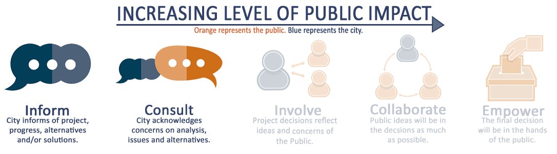
Level of Engagement
Important Documents
-
 BFR Open House 1 Boards.pdf (4.57 MB) (pdf)
-
Open House 2 Informational Boards (4.24 MB) (pdf)
-
Corridor Layout Concept A - One way Bikeways and Sidewalks (24.8 MB) (pdf)
-
Corridor Layout Concept B - Shared Use Paths (23.4 MB) (pdf)
-
Corridor Layout Concept C - Two way Bikeway and Sidewalks (24.5 MB) (pdf)
-
Open House 2 Comment Card (171 KB) (pdf)
-
Bloomington Ferry Road_City Council 12222025.pdf (1.87 MB) (pdf)
-
Bloomington Ferry Road Corridor Visioning Study Report_without Appendices.pdf (2.26 MB) (pdf)
