September 5,2023 - A draft of the Neighborhood Traffic Management Report is posted. Click the button to the right or find the document under the documents section on this page. A final draft will be posted later this week.
________________________________________________________
The City of Bloomington is developing a Neighborhood Traffic Management Program (NTMP) to unify the City’s existing traffic programs and create a comprehensive approach to managing traffic speeds, improving safety, and increasing local non-automobile access for residents across the city.
The NTMP will also identify improvements to the existing traffic programs, propose new programs that reflect the City’s commitment toContinue reading
September 5,2023 - A draft of the Neighborhood Traffic Management Report is posted. Click the button to the right or find the document under the documents section on this page. A final draft will be posted later this week.
________________________________________________________
The City of Bloomington is developing a Neighborhood Traffic Management Program (NTMP) to unify the City’s existing traffic programs and create a comprehensive approach to managing traffic speeds, improving safety, and increasing local non-automobile access for residents across the city.
The NTMP will also identify improvements to the existing traffic programs, propose new programs that reflect the City’s commitment to safety and livability of its neighborhoods, and make it easier for users to navigate the programs.
WHAT IS INCLUDED IN THE PROGRAM?
As part of this initiative, a set of strategies aimed at addressing existing safety challenges on local streets will be created. Three priorities of this project include:
- Changes to speed limits on local streets within the City (as proposed in the interactive map)
- Traffic calming measures in support of proposed speed limit changes
- Changes to new/existing City programs
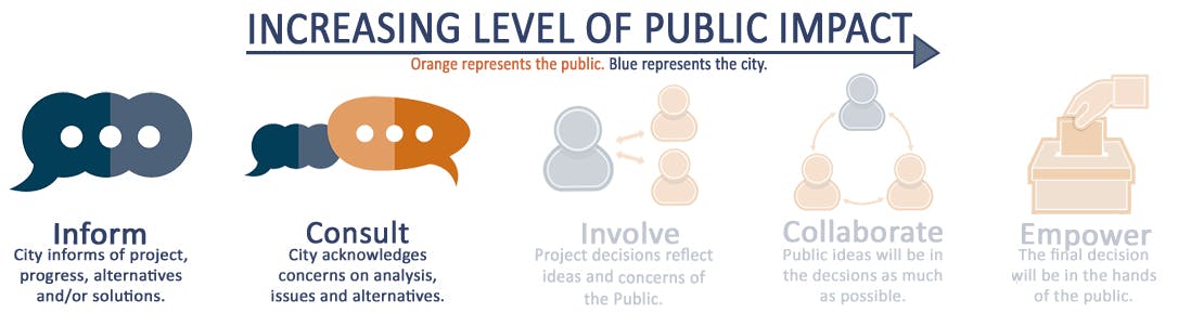
Click in "Stay Informed" to sign up for email updates to stay connected to the project and learn about ways you can be involved. Updates are generated by staff when site content changes.
*The City is concurrently developing an updated Active Transportation Action Plan that is focused on developing a plan to expand safe and convenient walking, bicycling and rolling (active transportation) options in the city . Your comments are welcome on both plans!
La ciudad de Bloomington está desarrollando un programa de gestión de tráfico vecinal (NTMP) para unificarse los existentes programas de tráfico y crear un proceso comprehensivo para gestionar las velocidades de tráfico, mejorar la seguridad, y aumentar acceso local al transporte no automovilístico para residentes a través de la ciudad.
El NTMP también identificará mejoras a los programas existentes de tráfico, propondrá nuevos programas que reflejen la promesa de la ciudad a la seguridad y habitabilidad de sus vecindarios, y facilitará la navegación de sus programas para sus residentes.
¿QUE SE INCLUYE EL PROGRAMA?
Como un parte de esta iniciativa, una colección de estrategias estará creado con la meta de abordar los desafíos de seguridad existentes en carreteras locales. Tres prioridades de este proyecto se incluyen:
- Cambios en el límite de velocidad en carreteras locales dentro de la ciudad (como se propone en el mapa interactivo)
- Medidas para calmar el tráfico para aportar los cambios de límite de velocidad propuestos
- Cambios en nuevas/existentes programas de la ciudad
Marque “Stay Informed” para registrarse para recibir actualizaciones por correo electrónico para mantenerse conectado con el proyecto y aprender sobre maneras en que puede participar. Actualizaciones están generados por personal de la ciudad cuando se cambia el contento del sitio web.
*La ciudad está simultáneo desarrollando un Plan de Acción de Transporte Activo que está enfocado en un plan para expandir opciones seguras de caminar, montar en bicicleta, andar, o movilizar en silla de ruedas en la ciudad. ¡Sus comentarios son bienvenidos en ambos planes!